
A project submitted by Joaquim Alves Gaspar, a researcher of the Portuguese Centro Interuniversitário de História das Ciências e da Tecnologia (CIUHCT), has been granted 1.2 million euros by the European Research Council (ERC). It is the first time that a European grant has been given to a research project in the field of the history of cartography.
The project is entitled “The Medieval and Early Modern Nautical Chart: Birth, Evolution and Use” and aims to create, in the next five years, an international team of seven researchers to study the genesis and evolution of ancient nautical cartography.
Dr. Gaspar, a retired officer of the Portuguese navy, has developed since 2002 a research career in the history of science, focusing on medieval and early modern nautical charts. He is now 67 and is affiliated with CIUCHT at the University of Lisbon.
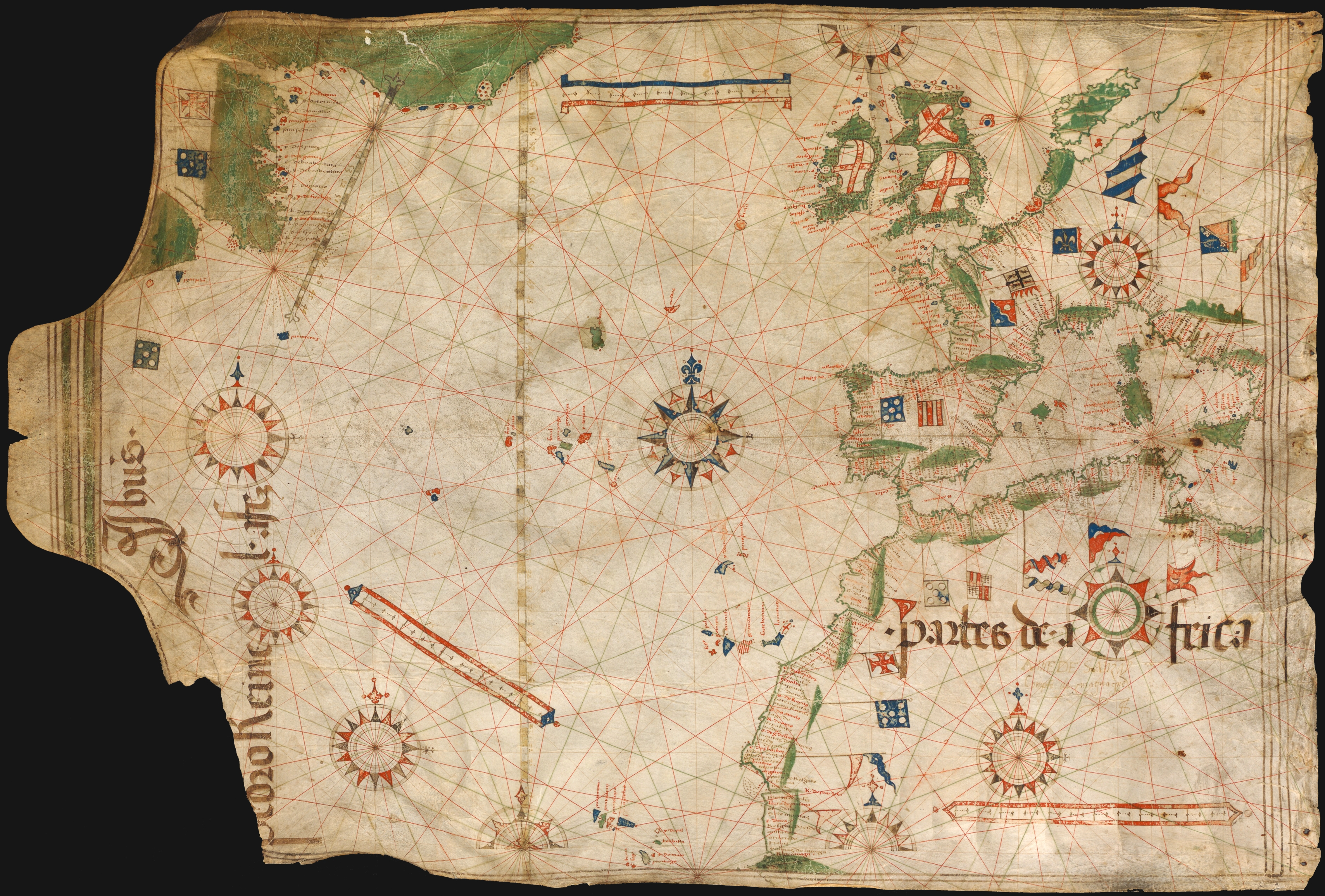
The project will analyze a large sample of maps, some of which had hitherto been little studied; for example, a chart made by Luís Teixeira in the last quarter of the 16th century that may be the first to show isogonic lines i.e. lines of constant magnetic declination, more than 100 years before Edmund Halley.
The project team will make use of two innovative tools to study the maps, aside from classical historical scholarship. One will be numerical ‘cartometric’ methods developed by Gaspar in the last decade. The other one will be special lightning tools, including multispectral analysis, a technique recently applied with success by other researchers to reveal unknown features of a 15th century world map.
Sources:
- Announcement at CIUCHT website.
- Article in newspaper Publico (in Portugese).
Project Abstract
Of all the technical and scientific developments that made possible the early modern maritime expansion, the nautical chart is perhaps the least studied and understood. This fact is very surprising as it was through those charts that the newly discovered world was first shown to the amazed eyes of the European nations. Although the History of Cartography is a well-established academic discipline and old charts have been examined for many years, their detailed technical study is still in its infancy. What is the origin of the pre-Mercator nautical chart, how charts evolved technically over time and how they were used at sea are all critical questions that remain to be answered.I intend to approach these challenges in a truly interdisciplinary way, by using innovative and powerful tools as a complement to the traditional methods of historical research: analytical cartometric methods, numerical modelling and the examination of the manuscripts through special lighting. By applying these tools to a large sample of charts of various periods and origins, I aim to unveil hidden graphic content related to their construction and use, to characterize their main geometric features, to establish meaningful connections with contemporary navigational methods and exploration missions, and to numerically simulate their construction by taking into account the explanations given in the textual sources. The effectiveness of those techniques has already been demonstrated in my previous studies, such as in the solution of an historical enigma which had been alive for more than a century: the construction of the Mercator projection, in 1569. Now, I propose to handle a broader and more complex set of questions, which has eluded the historians of cartography for even a longer period.The clarification of these issues will have a ground-breaking impact, not only in the strict field of the History of Cartography, but also in the context of the intellectual history at large.

Pingback: Primera beca europea de investigación para un proyecto en historia de la cartografía – Historia y Mapas